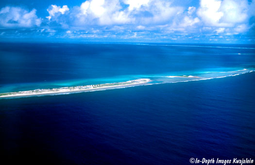
About 350 miles northwest of Kwajalein lies Enewetak Atoll, near the northwestern edge of the Marshall Islands. Enewetak (formerly called Eniwetok) is smaller than Kwajalein, only about 20 miles across and more circular in shape. On another page is a composite of aerial photographs put together by the US Department of Energy.
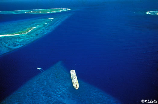
A deep water pass through the reef is in the southeastern portion of the atoll, a couple of islands north of the main island of Enewetak.
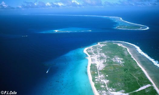
A shallow reef (just visible at left above) just in from the pass is marked with an abandoned concrete US WWII barge run up onto the reef as a marker. The reef itself comes to a sharp point in the direction of the pass and is swept by fierce currents at tidal changes. This is a rich area for marine life.
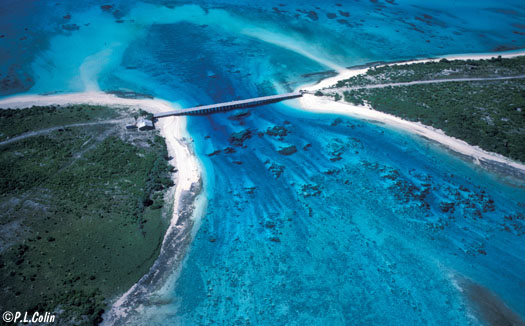
There are a couple of wide, shallower passes into the lagoon on the southwestern side of the atoll, but most of the reef rim is shallow, sometimes wth slightly deeper channels carved out by tidal currents racing over the reefs between the islands. Below is one such channel between the islands of Lojwa and Bijire. This channel, crossed by a bridge that has since collapsed, was home to many large giant clams when I first arrived in 1981. By the time I left in 1983, all that was left were the shells; the animals had all been fished out.
Like Kwajalein, the atoll was fortified by the Japanese during World War II and was invaded and captured by American forces in 1944. After the war, the local residents were moved to a smaller atoll called Ujelang while their home atoll was used for testing 43 nuclear devices.
After the testing some of the islands were too contaminated with radioactivity for normal habitation, although the US had a small presence there, including a small biological laboratory, on uncontaminated islands in the southern part of the atoll. On the southwestern side of the atoll, the island vegetation was in a more natural state and supported normal fauna such as coconut crabs. Finally, in the late 1970s, the US military cleaned up the atoll by removing testing debris and contaminated topsoil and encrypting it one of the fission blast craters on Runit Island. Having removed much of the very limited topsoil, fertilizers were brought in and a replanting project was undertaken to try to eventually return the atoll to at least something close to its pre-testing state. But nothing could bring back two islands completely vaporized by tests of the fusion device, the so-called hydrogen bomb.
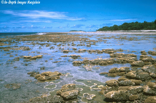
But despite the trauma of nuclear tests, the reefs are mostly alive, lush, and diverse. Below is a southwestern island reef flat at extreme low tide, with many of the corals exposed. Many of these shallow reef corals grow quickly. Every few years, a combination of a long very low tide on a cloudless and windless day when the swell is down and not pushing water up on the reef causes quite a few of these shallow corals to dry out and die in the heat, but they start coming back almost immediately.
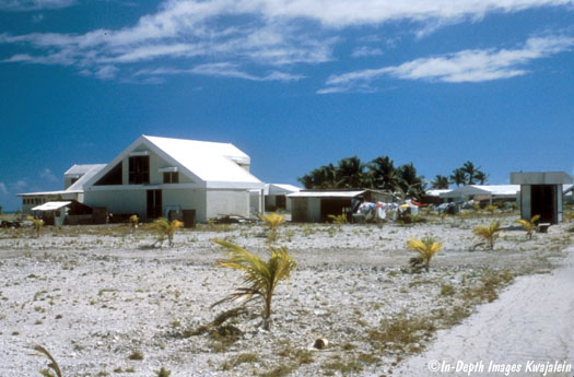
The Enewetakese were finally able to move back to the island and settle in concrete-over-foam houses built for them in 1980. The island was replanted with coconut palm trees at the time. When this picture was taken in 1981, the trees were mostly still very small. More recent photos I've seen show much more vegetation.
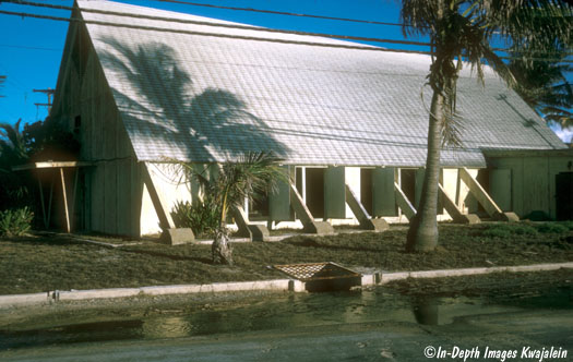
Much of the island required replanting because it had been mostly covered with buildings and pavement during the testing years. Most of those were removed during the cleanup. A few buildings were left, including this old chapel, which had not been used for its original purpose for some time. Even during my first trip in 1975, it was primarily a semi-indoor volleyball court, with the net strung from one side of the slanted ceiling to the other.
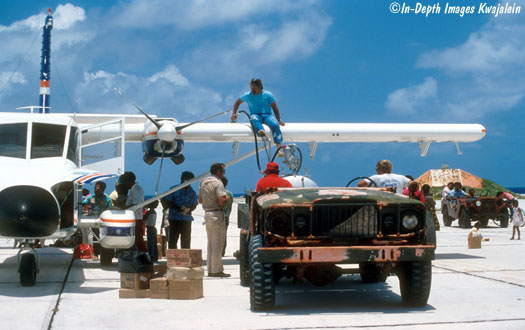
In the 1980s and to the present, the atoll was serviced by Airline of the Marshall Islands. Then, the 16-seater arrived every two weeks in theory; in practice, it was rather erratic.
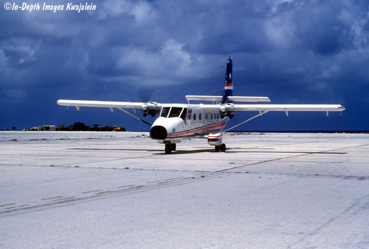
In 1975, there was a formal international terminal.
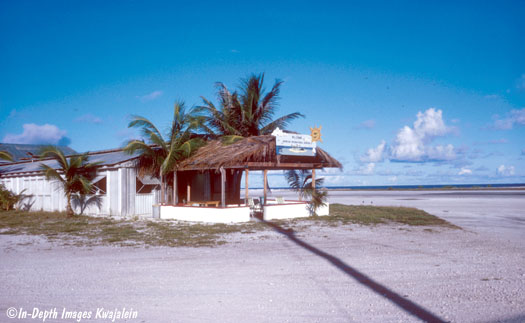
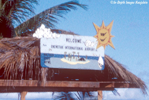
That was long gone by 1981 and the "terminal" was just an open spot on the runway.
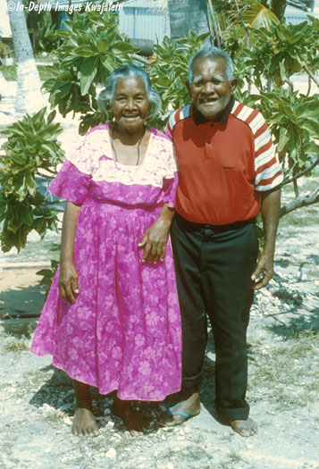
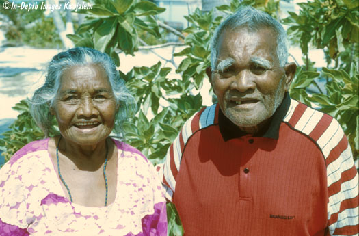
The 400 or so Enewetakese were governed by a magistrate--sort of a mayor--and council, and elected a senator to attend the Republic of the Marshall Islands' congress on Majuro Atoll. But the old king or "Iroij" was a respected elder. Here are the late Iroij, Joanej Peter and his wife Pila on a visit to the lab. We often ferried him to his "country home" on Japtan Island.
The Enewakese are a warm, friendly people. Here are a few more faces, mostly some of the younger folks in the early 1980s.
(Many thanks to Patrick L. Colin for the use of several aerial photos on this page.)
![]()