Sea level has been slowly rising in the Marshalls, according to records kept on a tidal gauge by the local weather station through the last half of the 20th century. The first few years of the 21st, though, the rate appeared to increase as much as tenfold. This should be expected considering the amount of water being lost by glaciers and ice caps sitting on land areas such as Greenland and Antarctica.
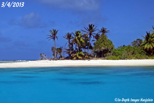
The land on atoll islands in the Marshalls and other island groups is not much higher than typical high tides, so they cannot take much of a rise without damage. The damage is easy to see. Most islands are suffering from some degree of erosion of old land area. A good example is the island of Bigej in Kwajalein Atoll. As seen through the dated photos below, the north end of the island was cut back a good hundred feet or more in just a year and a half.
Further examples of erosion on other Kwajalein Atoll islands can be seen can be seen for Ennubuj (Carlson), Roi's lagoon beach, Namur, Eru, Bokaluom, Torouji, and along both the ocean and lagoon shores of Kwajalein Island. There are many other examples.
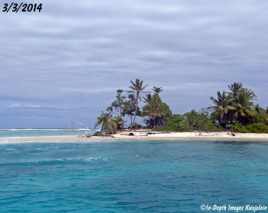
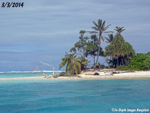
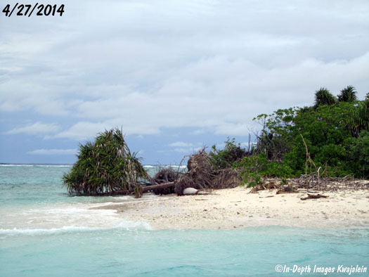
Between March 2013 and 3014, several palm trees were lost to erosion, putting one of two large pandanus trees very near the beach, and dead trees can be seen on the beach.
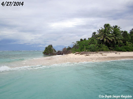
Just a couple of months later, both of the pandanus and all the palms from the cluster on the former end of the island were down or gone, with the remaining pandanus clinging to life while fallen over, lying in the water.
Press the Back button to return to the previous page.